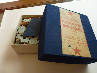
WARDS puzzle Map of United States – Handcut –
Number 48-650 – Montgomery Ward.
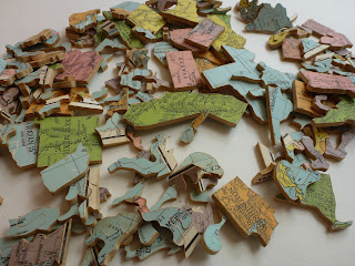
This puzzle was handcut using 3-ply wood. The
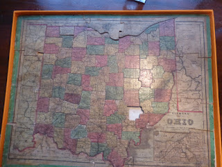
puzzle is double-sided and has a map of the USA without Alaska on one side and
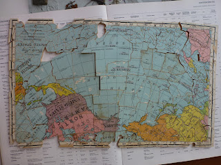
a map of US held territories on the other: Rand McNally Puzzle Map of the United
States ; and Rand McNally Puzzle Map of the United States and Possessions
showing territorial growth and geographical distribution (shows historical
growth within US). The pieces are amazingly intricate and not always
interlocking. The central pieces which show US states are cut into state
outline. Map measures 38 x 45 cm.
The box is the original from the 1930s
(estimated) but has been recovered. At some point the box suffered from water /
damp and the outer fabric was badly affected. I recovered the box in a material
similar to original (a small piece is included for comparison) and the original
label reused. The base has the original stamp.
As mentioned, at some point the puzzle was
exposed to water and some pieces of the ply-wood disintegrated. Three pieces
are pesent in this state and included separately. In addition several pieces
are missing – see photos – and part of the “possessions” puzzle are scuffed.
I would be happy to see this puzzle return to a
sympathetic restorer in the US. It is still an interesting piece of map /
puzzle ephemera and worth keeping / restoring and will soon be a hundred years
old. One example is at the Strong Museum of Play in Rochester, US.


Comments
Post a Comment